 vesseltracker.com
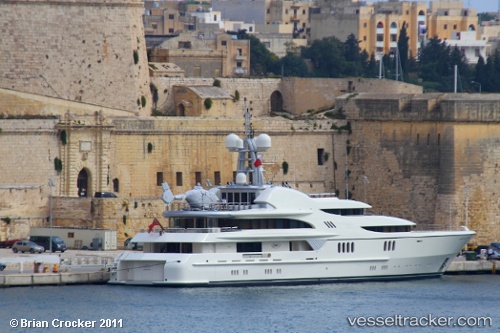
Vessel Anna I IMO: 1008994, MMSI: 319271000 Service Ship
UTC, 17.01251, -61.77098, course: 342, speed: 0
UTC, 17.01252, -61.77099, course: 340, speed: 0
2026-02-22 15:20:55 UTC, 17.01254, -61.77102, course: 341, speed: 0
Live AIS position:
UTC. Near ANTIGUA),
updated 2026-02-22 15:20:55 UTC.
Find the position of the vessel Anna I on the map. The latter are known coordinates and path.
marine traffic ship tracker show on live map
The current position of vessel Anna I is 17.01254 lat / -61.77102 lng. Updated: 2026-02-22 15:20:55 UTCCurrently sailing under the flag of Cayman Is
Anna I built in 2007 year
Details:
Last coordinates of the vessel:
UTC, 17.01250, -61.77096, course: 343, speed: 0UTC, 17.01251, -61.77098, course: 342, speed: 0
UTC, 17.01252, -61.77099, course: 340, speed: 0
2026-02-22 15:20:55 UTC, 17.01254, -61.77102, course: 341, speed: 0