vessel Atlantic Peace IMO: 8704999, Fishing Vessel
Vessel Atlantic Peace IMO: 8704999, Fishing Vessel
MMSI: 601202400 callsign: ZR5214 size: 57x13

Find the position of the vessel Atlantic Peace on the map. The latter are known coordinates and path.

marine traffic ship tracker show on live map

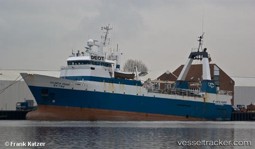
The current position of vessel Atlantic Peace is -33.0243 lat / 17.9553 lng. Updated: 2023-03-24 06:51:41 UTC

Currently sailing under the flag of South Africa

Atlantic Peace built in 1987 year

Deadweight:
865 t

Gross tonnage:
1597
Service entry:
1987-01-01T00:00:00Z

Manufacturer:
Sterkoder (shipyard in Norway)
Details:


Last coordinates of the vessel:
2023-03-24 06:51:41 UTC, -33.0243, 17.9553, course: 351.6, speed: 0

Track of the vessel in the last 14 days


Most frequent ports a vessels calls at Atlantic Peace (601202400):

Saldanha Bay, traffic: 7
Simons Bay, traffic: 3
Cape Of Good Hope, traffic: 2
Cape Town, traffic: 2
Mosselbaai, traffic: 2
Mosselbay, traffic: 2

Link to the map:


Find another ship

Atlantic_Peace (601202400) last ports (portcalls and passsages)

Saldanha Bay | 2022-07-21 19:50:35
Saldanha Bay | 2022-06-01 01:40:07
Simons Bay | 2022-05-18 04:09:37
Saldanha Bay | 2022-05-09 22:32:04
Saldanha Bay | 2022-05-05 13:26:50
Saldanha Bay | 2022-03-16 23:49:36
Cape Of Good Hope | 2022-03-16 15:40:04
Mosselbaai | 2022-02-17 09:00:02
Simons Bay | 2022-02-04 15:35:05
Saldanha Bay | 2022-01-14 12:25:04
Cape Town | 2021-12-01 00:01:57