 vesseltracker.com
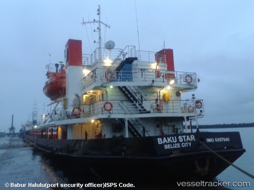
Vessel BAKU STAR IMO: 8867040, MMSI: 273352800 General Cargo
UTC, 45.03833, 47.70333, course: -1, speed: 0
UTC, 45.03833, 47.70333, course: -1, speed: 0
2026-02-13 01:13:18 UTC, 45.03833, 47.70333, course: -1, speed: 0
Live AIS position:
UTC. 45 nm S of Olya),
updated 2026-02-13 01:13:18 UTC.
Find the position of the vessel BAKU STAR on the map. The latter are known coordinates and path.
marine traffic ship tracker show on live map
The current position of vessel BAKU STAR is 45.03833 lat / 47.70333 lng. Updated: 2026-02-13 01:13:18 UTCCurrently sailing under the flag of Russia
BAKU STAR built in 1989 year
Deadweight:
2957 tDetails:
Last coordinates of the vessel:
UTC, 45.03833, 47.70333, course: -1, speed: 0UTC, 45.03833, 47.70333, course: -1, speed: 0
UTC, 45.03833, 47.70333, course: -1, speed: 0
2026-02-13 01:13:18 UTC, 45.03833, 47.70333, course: -1, speed: 0