 vesseltracker.com
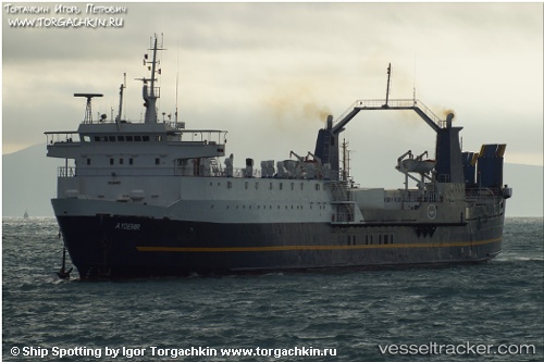
Vessel BARBAROS IMO: 7619537, MMSI: 613907412 Ro-Ro Cargo Ship
UTC, 35.19930, 33.99292, course: 222, speed: 9.5
UTC, 35.19930, 33.99292, course: 222, speed: 9.5
2026-02-08 06:49:12 UTC, 35.16029, 33.94526, course: 115, speed: 0
Live AIS position:
UTC. Near Famagusta),
updated 2026-02-08 06:49:12 UTC.
Find the position of the vessel BARBAROS on the map. The latter are known coordinates and path.
marine traffic ship tracker show on live map
The current position of vessel BARBAROS is 35.16029 lat / 33.94526 lng. Updated: 2026-02-08 06:49:12 UTCCurrently sailing under the flag of Cameroon
BARBAROS built in 1980 year
Deadweight:
3980 tDetails:
Last coordinates of the vessel:
UTC, 35.48128, 34.41118, course: 229, speed: 10.6UTC, 35.19930, 33.99292, course: 222, speed: 9.5
UTC, 35.19930, 33.99292, course: 222, speed: 9.5
2026-02-08 06:49:12 UTC, 35.16029, 33.94526, course: 115, speed: 0