 vesseltracker.com
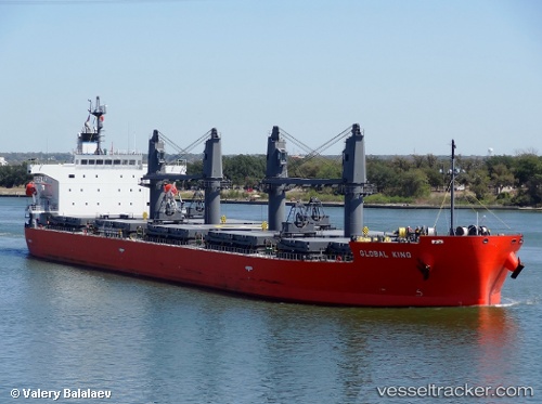
Vessel BAY PEARL IMO: 9460801, MMSI: 311001087 Bulk Carrier
UTC, 10.35851, -61.54252, course: 77, speed: 0
UTC, 10.35782, -61.54228, course: 58, speed: 0.2
2026-02-05 14:16:00 UTC, 10.35907, -61.54273, course: 96, speed: 0
Live AIS position:
UTC. Near POINT LISAS),
updated 2026-02-05 14:16:00 UTC.
Find the position of the vessel BAY PEARL on the map. The latter are known coordinates and path.
marine traffic ship tracker show on live map
The current position of vessel BAY PEARL is 10.35907 lat / -61.54273 lng. Updated: 2026-02-05 14:16:00 UTCCurrently sailing under the flag of Bahamas
BAY PEARL built in 2011 year
Deadweight:
51703 tDetails:
Last coordinates of the vessel:
UTC, 10.35832, -61.54251, course: 69, speed: 0UTC, 10.35851, -61.54252, course: 77, speed: 0
UTC, 10.35782, -61.54228, course: 58, speed: 0.2
2026-02-05 14:16:00 UTC, 10.35907, -61.54273, course: 96, speed: 0