 vesseltracker.com
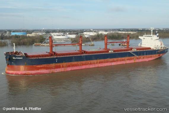
Vessel BELFOREST IMO: 9698185, MMSI: 259135000 Bulk Carrier
UTC, 31.20910, 122.59940, course: 306, speed: 0
UTC, 31.20873, 122.59704, course: 24, speed: 0.2
2026-02-04 13:26:31 UTC, 31.21146, 122.59576, course: 117, speed: 0.1
Live AIS position:
UTC. 13 nm NE of Jingjiang),
updated 2026-02-04 13:26:31 UTC.
Find the position of the vessel BELFOREST on the map. The latter are known coordinates and path.
marine traffic ship tracker show on live map
The current position of vessel BELFOREST is 31.21146 lat / 122.59576 lng. Updated: 2026-02-04 13:26:31 UTCCurrently sailing under the flag of Norway (NIS)
BELFOREST built in 2015 year
Deadweight:
61252 tDetails:
Last coordinates of the vessel:
UTC, 31.21032, 122.59927, course: 284, speed: 0UTC, 31.20910, 122.59940, course: 306, speed: 0
UTC, 31.20873, 122.59704, course: 24, speed: 0.2
2026-02-04 13:26:31 UTC, 31.21146, 122.59576, course: 117, speed: 0.1