 vesseltracker.com
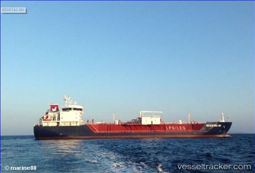
Vessel BESIKTAS GH IMO: 9654971, MMSI: 538009493 LPG Tanker
UTC, -29.90167, -51.37333, course: -1, speed: 0
UTC, -29.90167, -51.37333, course: -1, speed: 0
2026-02-04 17:26:37 UTC, -29.90167, -51.37333, course: -1, speed: 0
Live AIS position:
UTC. Near SANTA CLARA),
updated 2026-02-04 17:26:37 UTC.
Find the position of the vessel BESIKTAS GH on the map. The latter are known coordinates and path.
marine traffic ship tracker show on live map
The current position of vessel BESIKTAS GH is -29.90167 lat / -51.37333 lng. Updated: 2026-02-04 17:26:37 UTCCurrently sailing under the flag of Marshall Islands
BESIKTAS GH built in 2013 year
Deadweight:
9212 tDetails:
Last coordinates of the vessel:
UTC, -29.90167, -51.37333, course: -1, speed: 0UTC, -29.90167, -51.37333, course: -1, speed: 0
UTC, -29.90167, -51.37333, course: -1, speed: 0
2026-02-04 17:26:37 UTC, -29.90167, -51.37333, course: -1, speed: 0