 vesseltracker.com
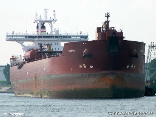
Vessel BLUE LAGOON I IMO: 9248447, MMSI: 352002351 Crude Oil Tanker
UTC, 42.57400, 36.74383, course: 338, speed: 1.1
UTC, 42.58933, 36.78067, course: 329, speed: 1
2026-02-07 21:32:41 UTC, 42.60333, 36.83017, course: 341, speed: 1.1
Live AIS position:
UTC. 65 nm NE of Gerze),
updated 2026-02-07 21:32:41 UTC.
Find the position of the vessel BLUE LAGOON I on the map. The latter are known coordinates and path.
marine traffic ship tracker show on live map
The current position of vessel BLUE LAGOON I is 42.60333 lat / 36.83017 lng. Updated: 2026-02-07 21:32:41 UTCCurrently sailing under the flag of Panama
BLUE LAGOON I built in 2003 year
Deadweight:
148553 tDetails:
Last coordinates of the vessel:
UTC, 42.54633, 36.67850, course: 347, speed: 1.4UTC, 42.57400, 36.74383, course: 338, speed: 1.1
UTC, 42.58933, 36.78067, course: 329, speed: 1
2026-02-07 21:32:41 UTC, 42.60333, 36.83017, course: 341, speed: 1.1