 vesseltracker.com
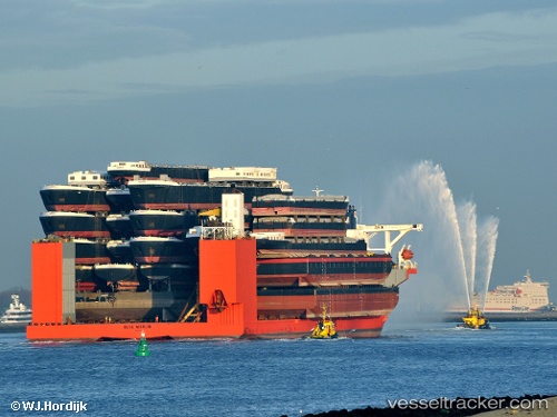
Vessel BLUE MARLIN IMO: 9186338, MMSI: 248314000 Heavy Load Carrier
UTC, 3.44245, 105.61613, course: 59, speed: 8
UTC, 3.61537, 105.94953, course: 59, speed: 8.5
2026-02-09 06:21:02 UTC, 3.61537, 105.94953, course: 59, speed: 8.5
Live AIS position:
UTC. 29 nm NW of Terempa),
updated 2026-02-09 06:21:02 UTC.
Find the position of the vessel BLUE MARLIN on the map. The latter are known coordinates and path.
marine traffic ship tracker show on live map
The current position of vessel BLUE MARLIN is 3.61537 lat / 105.94953 lng. Updated: 2026-02-09 06:21:02 UTCCurrently sailing under the flag of Malta
BLUE MARLIN built in 2000 year
Deadweight:
76061 tDetails:
Last coordinates of the vessel:
UTC, 3.44245, 105.61613, course: 59, speed: 8UTC, 3.44245, 105.61613, course: 59, speed: 8
UTC, 3.61537, 105.94953, course: 59, speed: 8.5
2026-02-09 06:21:02 UTC, 3.61537, 105.94953, course: 59, speed: 8.5