 vesseltracker.com
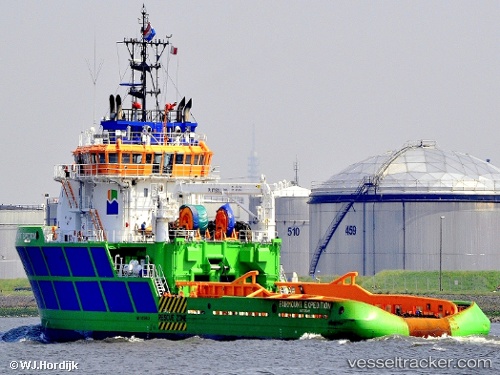
Vessel 'BOKA EXPEDITION' IMO: 9358943, MMSI: 215337000
UTC, 5.79552, 84.6896, course: 88, speed: 6.2
UTC, 5.80833, 84.9767, course: -1, speed: 5
2026-02-05 09:26:22 UTC, 5.81205, 85.0846, course: 90, speed: 5.5
Live AIS position:
UTC. 63 nm SW of Abakaliki),
updated 2026-02-05 09:26:22 UTC.
Find the position of the vessel 'BOKA EXPEDITION' on the map. The latter are known coordinates and path.
marine traffic ship tracker show on live map
The current position of vessel 'BOKA EXPEDITION' is 5.81205 lat / 85.0846 lng. Updated: 2026-02-05 09:26:22 UTCDetails:
Last coordinates of the vessel:
UTC, 5.78719, 84.4908, course: 89, speed: 5.9UTC, 5.79552, 84.6896, course: 88, speed: 6.2
UTC, 5.80833, 84.9767, course: -1, speed: 5
2026-02-05 09:26:22 UTC, 5.81205, 85.0846, course: 90, speed: 5.5