 vesseltracker.com
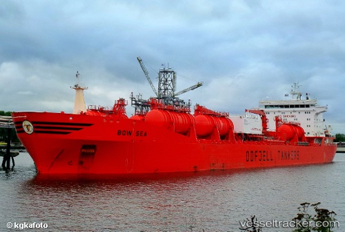
Vessel BOW SEA IMO: 9215282, MMSI: 257894000 Chemical/Oil Products Tanker
UTC, 28.61329, -15.12918, course: 197, speed: 13.2
UTC, 28.29658, -15.25103, course: 213, speed: 8.6
2026-01-31 07:40:14 UTC, 28.12061, -15.37306, course: 254, speed: 0.9
Live AIS position:
UTC. Near Las Palmas de Gran Canaria),
updated 2026-01-31 07:40:14 UTC.
Find the position of the vessel BOW SEA on the map. The latter are known coordinates and path.
marine traffic ship tracker show on live map
The current position of vessel BOW SEA is 28.12061 lat / -15.37306 lng. Updated: 2026-01-31 07:40:14 UTCCurrently sailing under the flag of Norway (NIS)
BOW SEA built in 2006 year
Deadweight:
49511 tDetails:
Last coordinates of the vessel:
UTC, 29.01144, -14.98764, course: 197, speed: 13.4UTC, 28.61329, -15.12918, course: 197, speed: 13.2
UTC, 28.29658, -15.25103, course: 213, speed: 8.6
2026-01-31 07:40:14 UTC, 28.12061, -15.37306, course: 254, speed: 0.9