 vesseltracker.com
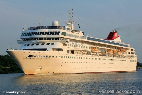
Vessel Villa Vie Odyssey IMO: 9000699, MMSI: 311541000 Cruise Ship
UTC, -18.30782, -160.99345, course: 264, speed: 10.9
2026-01-22 11:49:49 UTC, -18.33608, -161.41978, course: 261, speed: 11.3
Live AIS position:
UTC. 195 nm NW of Avarua),
updated 2026-01-22 11:49:49 UTC.
ex Braemar
Find the position of the vessel Villa Vie Odyssey on the map. The latter are known coordinates and path.
marine traffic ship tracker show on live map
The current position of vessel Villa Vie Odyssey is -18.33608 lat / -161.41978 lng. Updated: 2026-01-22 11:49:49 UTCCurrently sailing under the flag of Bahamas
Villa Vie Odyssey built in 1993 year
Deadweight:
3463 tDetails:
ex Braemar
Last coordinates of the vessel:
UTC, -18.21078, -159.62592, course: 264, speed: 11.1UTC, -18.30782, -160.99345, course: 264, speed: 10.9
2026-01-22 11:49:49 UTC, -18.33608, -161.41978, course: 261, speed: 11.3