 vesseltracker.com
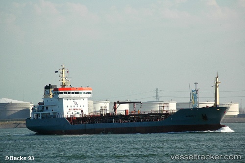
Vessel BRAVE IMO: 9242730, MMSI: 314658000 Chemical Oil Products Tanker
UTC, 24.73931, 56.54633, course: 136, speed: 0
UTC, 24.73926, 56.54638, course: 139, speed: 0
2026-02-05 21:48:37 UTC, 24.73918, 56.54629, course: 132, speed: 0
Live AIS position:
UTC. Near SHINAS),
updated 2026-02-05 21:48:37 UTC.
Find the position of the vessel BRAVE on the map. The latter are known coordinates and path.
marine traffic ship tracker show on live map
The current position of vessel BRAVE is 24.73918 lat / 56.54629 lng. Updated: 2026-02-05 21:48:37 UTCCurrently sailing under the flag of Barbados
BRAVE built in 2002 year
Deadweight:
6711 tDetails:
Last coordinates of the vessel:
UTC, 24.73931, 56.54624, course: 136, speed: 0UTC, 24.73931, 56.54633, course: 136, speed: 0
UTC, 24.73926, 56.54638, course: 139, speed: 0
2026-02-05 21:48:37 UTC, 24.73918, 56.54629, course: 132, speed: 0