 vesseltracker.com
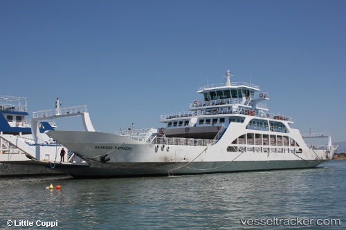
Vessel Bahariye IMO: 8734396, MMSI: 271043393 Passenger Ro Ro Cargo Ship
UTC, 40.70526, 29.44718, course: -1, speed: 10.3
UTC, 40.76736, 29.42500, course: -1, speed: 0
2026-02-13 20:20:32 UTC, 40.75137, 29.43156, course: -1, speed: 9.6
Live AIS position:
UTC. Near ESKIHISAR),
updated 2026-02-13 20:20:32 UTC.
Find the position of the vessel Bahariye on the map. The latter are known coordinates and path.
marine traffic ship tracker show on live map
The current position of vessel Bahariye is 40.75137 lat / 29.43156 lng. Updated: 2026-02-13 20:20:32 UTCCurrently sailing under the flag of Turkey
Bahariye built in 2006 year
Details:
Last coordinates of the vessel:
UTC, 40.69490, 29.44611, course: -1, speed: 0UTC, 40.70526, 29.44718, course: -1, speed: 10.3
UTC, 40.76736, 29.42500, course: -1, speed: 0
2026-02-13 20:20:32 UTC, 40.75137, 29.43156, course: -1, speed: 9.6