 vesseltracker.com
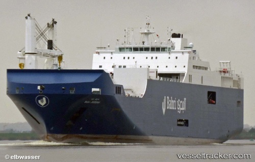
Vessel Bahri Jeddah IMO: 9626522, MMSI: 403531001 Ro Ro Cargo Ship
UTC, -17.52388, 56.19565, course: 229, speed: 7.9
UTC, -17.62756, 56.07311, course: 220, speed: 8.3
2026-02-13 17:19:02 UTC, -17.82170, 55.88168, course: 225, speed: 8.4
Live AIS position:
UTC. 162 nm NW of Pointe aux Canonniers),
updated 2026-02-13 17:19:02 UTC.
Find the position of the vessel Bahri Jeddah on the map. The latter are known coordinates and path.
marine traffic ship tracker show on live map
The current position of vessel Bahri Jeddah is -17.82170 lat / 55.88168 lng. Updated: 2026-02-13 17:19:02 UTCDetails:
Last coordinates of the vessel:
UTC, -17.29046, 56.44050, course: 220, speed: 8UTC, -17.52388, 56.19565, course: 229, speed: 7.9
UTC, -17.62756, 56.07311, course: 220, speed: 8.3
2026-02-13 17:19:02 UTC, -17.82170, 55.88168, course: 225, speed: 8.4