 vesseltracker.com
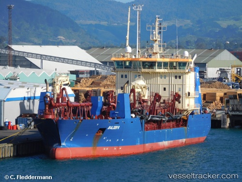
Vessel Balder R IMO: 9578232, MMSI: 219298000 Hopper Dredger
Live AIS position:
UTC. Near THYBORON),
updated 2025-10-02 09:38:12 UTC.
Find the position of the vessel Balder R on the map. The latter are known coordinates and path.
marine traffic ship tracker show on live map
The current position of vessel Balder R is 56.69302 lat / 8.22531 lng. Updated: 2025-10-02 09:38:12 UTCDetails:
Last coordinates of the vessel:
2025-10-02 09:38:12 UTC, 56.69302, 8.22531, course: -1, speed: 0