 vesseltracker.com
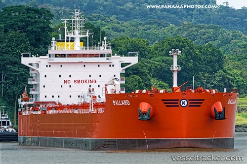
Vessel Ballard IMO: 9729738, MMSI: 538007099 Bulk Oil Carrier
Live AIS position:
UTC. 237 nm W of Bolinao),
updated 2025-12-07 12:53:58 UTC.
Find the position of the vessel Ballard on the map. The latter are known coordinates and path.
marine traffic ship tracker show on live map
The current position of vessel Ballard is 16.68188 lat / 115.77258 lng. Updated: 2025-12-07 12:53:58 UTCCurrently sailing under the flag of Marshall Is
Details:
Last coordinates of the vessel:
2025-12-07 12:53:58 UTC, 16.68188, 115.77258, course: 37, speed: 6.3