 vesseltracker.com
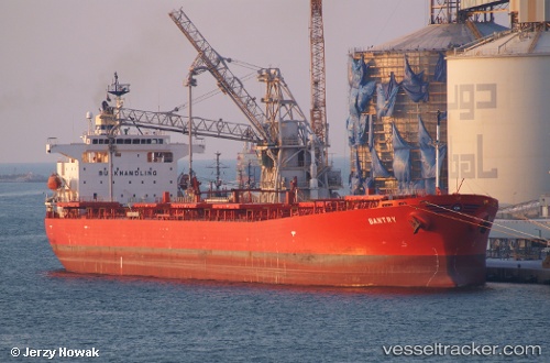
Vessel Bantry IMO: 9304069, MMSI: 538002418 Bulk Oil Carrier
UTC, 37.65443, 120.30242, course: 355, speed: 0
UTC, 37.65447, 120.30240, course: 355, speed: 0
2026-02-09 23:27:12 UTC, 37.65442, 120.30247, course: 355, speed: 0
Live AIS position:
UTC. Near Longkou),
updated 2026-02-09 23:27:12 UTC.
Find the position of the vessel Bantry on the map. The latter are known coordinates and path.
marine traffic ship tracker show on live map
The current position of vessel Bantry is 37.65442 lat / 120.30247 lng. Updated: 2026-02-09 23:27:12 UTCDetails:
Last coordinates of the vessel:
UTC, 37.65452, 120.30238, course: 355, speed: 0UTC, 37.65443, 120.30242, course: 355, speed: 0
UTC, 37.65447, 120.30240, course: 355, speed: 0
2026-02-09 23:27:12 UTC, 37.65442, 120.30247, course: 355, speed: 0