 vesseltracker.com
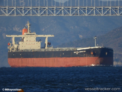
Vessel Baosteel Expedition IMO: 9346184, MMSI: 636013163 Ore Carrier
UTC, -22.14704, 82.08288, course: 61, speed: 10.5
UTC, -22.00682, 82.35627, course: 56, speed: 10.6
2026-02-09 11:46:39 UTC, -21.81716, 82.69619, course: 52, speed: 10.8
Live AIS position:
UTC. Open sea (no nearby ports in database)),
updated 2026-02-09 11:46:39 UTC.
Find the position of the vessel Baosteel Expedition on the map. The latter are known coordinates and path.
marine traffic ship tracker show on live map
The current position of vessel Baosteel Expedition is -21.81716 lat / 82.69619 lng. Updated: 2026-02-09 11:46:39 UTCDetails:
Last coordinates of the vessel:
UTC, -22.30580, 81.78782, course: 61, speed: 10.7UTC, -22.14704, 82.08288, course: 61, speed: 10.5
UTC, -22.00682, 82.35627, course: 56, speed: 10.6
2026-02-09 11:46:39 UTC, -21.81716, 82.69619, course: 52, speed: 10.8