 vesseltracker.com
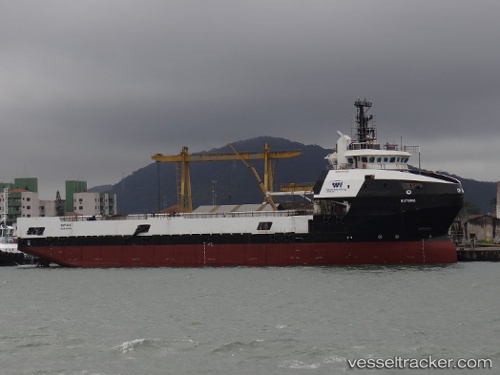
Vessel Batuira IMO: 9573256, MMSI: 710011270 Offshore Tug Supply Ship
UTC, -24.55511, -42.16890, course: 174, speed: 0.1
UTC, -24.55504, -42.16886, course: 174, speed: 0.3
2026-02-05 13:53:42 UTC, -24.56000, -42.16907, course: 175, speed: 0.4
Live AIS position:
UTC. 69 nm NE of Cidade de Angra dos Reis FPSO),
updated 2026-02-05 13:53:42 UTC.
Find the position of the vessel Batuira on the map. The latter are known coordinates and path.
marine traffic ship tracker show on live map
The current position of vessel Batuira is -24.56000 lat / -42.16907 lng. Updated: 2026-02-05 13:53:42 UTCDetails:
Last coordinates of the vessel:
UTC, -24.55513, -42.16892, course: 175, speed: 0.4UTC, -24.55511, -42.16890, course: 174, speed: 0.1
UTC, -24.55504, -42.16886, course: 174, speed: 0.3
2026-02-05 13:53:42 UTC, -24.56000, -42.16907, course: 175, speed: 0.4