 vesseltracker.com
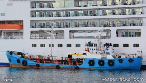
Vessel Bawa 1 IMO: 7228467, MMSI: 248138000 Service Ship
UTC, 35.86212, 14.60099, course: -1, speed: 8.3
UTC, 35.83861, 14.60335, course: -1, speed: 1.3
2026-02-06 13:44:08 UTC, 35.83837, 14.60301, course: -1, speed: 0.7
Live AIS position:
UTC. Near Il-Kappara),
updated 2026-02-06 13:44:08 UTC.
Find the position of the vessel Bawa 1 on the map. The latter are known coordinates and path.
marine traffic ship tracker show on live map
The current position of vessel Bawa 1 is 35.83837 lat / 14.60301 lng. Updated: 2026-02-06 13:44:08 UTCCurrently sailing under the flag of Malta
Bawa 1 built in 1972 year
Deadweight:
421 tDetails:
Last coordinates of the vessel:
UTC, 35.90190, 14.52655, course: -1, speed: 7.5UTC, 35.86212, 14.60099, course: -1, speed: 8.3
UTC, 35.83861, 14.60335, course: -1, speed: 1.3
2026-02-06 13:44:08 UTC, 35.83837, 14.60301, course: -1, speed: 0.7