 vesseltracker.com
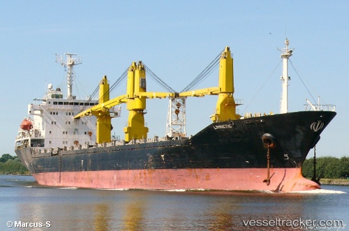
Vessel Behshad IMO: 9167289, MMSI: 422036200 General Cargo Ship
UTC, 27.35705, 51.29153, course: -1, speed: 0.9
UTC, 28.19885, 51.10634, course: -1, speed: 1.1
2026-02-01 13:32:10 UTC, 28.19885, 51.10634, course: -1, speed: 1.1
Live AIS position:
UTC. 19 nm S of AMERI),
updated 2026-02-01 13:32:10 UTC.
Find the position of the vessel Behshad on the map. The latter are known coordinates and path.
marine traffic ship tracker show on live map
The current position of vessel Behshad is 28.19885 lat / 51.10634 lng. Updated: 2026-02-01 13:32:10 UTCDetails:
Last coordinates of the vessel:
UTC, 27.35705, 51.29153, course: -1, speed: 0.9UTC, 27.35705, 51.29153, course: -1, speed: 0.9
UTC, 28.19885, 51.10634, course: -1, speed: 1.1
2026-02-01 13:32:10 UTC, 28.19885, 51.10634, course: -1, speed: 1.1