 vesseltracker.com
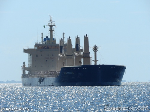
Vessel Ben Rinnes IMO: 9703825, MMSI: 538006425 Bulk Carrier
UTC, 24.37333, 59.60500, course: -1, speed: 0
UTC, 24.39333, 59.60667, course: -1, speed: 0
2026-02-03 09:51:11 UTC, 24.40978, 59.59738, course: 15, speed: 0.8
Live AIS position:
UTC. 71 nm NE of Port Sultan),
updated 2026-02-03 09:51:11 UTC.
Find the position of the vessel Ben Rinnes on the map. The latter are known coordinates and path.
marine traffic ship tracker show on live map
The current position of vessel Ben Rinnes is 24.40978 lat / 59.59738 lng. Updated: 2026-02-03 09:51:11 UTCDetails:
Last coordinates of the vessel:
UTC, 24.35667, 59.59833, course: -1, speed: 0UTC, 24.37333, 59.60500, course: -1, speed: 0
UTC, 24.39333, 59.60667, course: -1, speed: 0
2026-02-03 09:51:11 UTC, 24.40978, 59.59738, course: 15, speed: 0.8