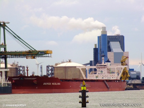
vessel Berge Neblina IMO: 9447562, Ore Carrier
vesseltracker.com
Vessel Berge Neblina IMO: 9447562, Ore Carrier
MMSI: 235094793 callsign: 2FWI7 size: 65x361

Find the position of the vessel Berge Neblina on the map. The latter are known coordinates and path.

marine traffic ship tracker show on live map

The current position of vessel Berge Neblina is 4.79245 lat / 109.444 lng. Updated: 2024-04-18 00:15:44 UTC
Port of registry:
Douglas (capital city of the Isle of Man)
Payload_mass:
388000 tonne
Gross tonnage:
195199
Service entry:
2013-01-01T00:00:00Z
Details:


Last coordinates of the vessel:
UTC, 4.54851, 109.321, course: 27, speed: 12.6
UTC, 4.64603, 109.369, course: 27, speed: 12.9
UTC, 4.79245, 109.444, course: 31, speed: 11.7
2024-04-18 00:15:44 UTC, 4.79245, 109.444, course: 31, speed: 11.7

Track of the vessel in the last 14 days


Most frequent ports a vessels calls at Berge Neblina (235094793):

Sao Luiz, traffic: 9
Singapore, traffic: 3
Sambu, traffic: 3
Tubarao, traffic: 2
Ponta da Madeira, traffic: 2
Cape Of Good Hope, traffic: 1
Port Louis, traffic: 1

Link to the map:


Find another ship

Berge_Neblina (235094793) last ports (portcalls and passsages)

Tubarao | 2024-03-11 08:32:47
Tubarao | 2024-03-07 01:58:22
Ponta da Madeira | 2023-12-06 23:24:40
Sao Luiz | 2023-12-06 07:02:08
Sao Luiz | 2023-12-02 06:50:30
Sambu | 2023-11-01 14:44:05
Ponta da Madeira | 2023-08-29 03:00:58
Singapore | 2023-07-24 07:52:29
Sambu | 2023-07-24 07:21:09
Sao Luiz | 2023-05-21 05:17:20
Singapore | 2023-03-29 11:09:06
Port Louis | 2023-03-02 08:52:09
Sao Luiz | 2023-02-03 02:51:07
Sao Luiz | 2022-10-19 01:25:14
Sao Luiz | 2022-07-25 07:11:09
Cape Of Good Hope | 2022-03-22 21:55:19
Sao Luiz | 2021-12-01 00:01:08