 vesseltracker.com
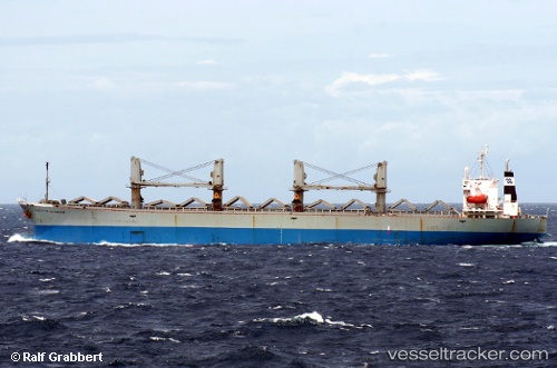
Vessel Best Traveller IMO: 9116644, MMSI: 374634000 Bulk Carrier
UTC, 25.02011, 57.64684, course: 306, speed: 12.2
UTC, 25.08904, 57.53571, course: 304, speed: 12.2
2026-02-02 07:55:18 UTC, 25.08904, 57.53571, course: 304, speed: 12.2
Live AIS position:
UTC. 36 nm S of JASK),
updated 2026-02-02 07:55:18 UTC.
Find the position of the vessel Best Traveller on the map. The latter are known coordinates and path.
marine traffic ship tracker show on live map
The current position of vessel Best Traveller is 25.08904 lat / 57.53571 lng. Updated: 2026-02-02 07:55:18 UTCDetails:
Last coordinates of the vessel:
UTC, 24.81613, 57.97564, course: 308, speed: 12.4UTC, 25.02011, 57.64684, course: 306, speed: 12.2
UTC, 25.08904, 57.53571, course: 304, speed: 12.2
2026-02-02 07:55:18 UTC, 25.08904, 57.53571, course: 304, speed: 12.2