 vesseltracker.com
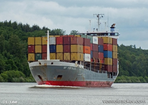
Vessel Bf Fortaleza IMO: 9130432, MMSI: 212723000 Container Ship
UTC, 17.47028, -88.20056, course: 181, speed: 5.1
UTC, 17.27623, -88.00387, course: 165, speed: 13.1
2026-02-05 13:48:46 UTC, 17.05573, -87.63100, course: 95, speed: 12.3
Live AIS position:
UTC. 34 nm E of Dangriga),
updated 2026-02-05 13:48:46 UTC.
Find the position of the vessel Bf Fortaleza on the map. The latter are known coordinates and path.
marine traffic ship tracker show on live map
The current position of vessel Bf Fortaleza is 17.05573 lat / -87.63100 lng. Updated: 2026-02-05 13:48:46 UTCCurrently sailing under the flag of Cyprus
Bf Fortaleza built in 1996 year
Deadweight:
7202 tDetails:
Last coordinates of the vessel:
UTC, 17.47373, -88.20137, course: 120, speed: 0UTC, 17.47028, -88.20056, course: 181, speed: 5.1
UTC, 17.27623, -88.00387, course: 165, speed: 13.1
2026-02-05 13:48:46 UTC, 17.05573, -87.63100, course: 95, speed: 12.3