 vesseltracker.com
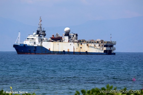
Vessel Bgp Explorer IMO: 9441544, MMSI: 357065000 Research Vessel
UTC, 28.18333, 49.15500, course: -1, speed: 3
UTC, 28.21539, 49.07563, course: 298, speed: 4.8
2026-02-05 03:42:26 UTC, 28.18333, 49.13500, course: -1, speed: 4
Live AIS position:
UTC. 22 nm E of Bandar Al Mishab),
updated 2026-02-05 03:42:26 UTC.
Find the position of the vessel Bgp Explorer on the map. The latter are known coordinates and path.
marine traffic ship tracker show on live map
The current position of vessel Bgp Explorer is 28.18333 lat / 49.13500 lng. Updated: 2026-02-05 03:42:26 UTCCurrently sailing under the flag of Panama
Bgp Explorer built in 2008 year
Deadweight:
899 tDetails:
Last coordinates of the vessel:
UTC, 28.21667, 49.07167, course: -1, speed: 4UTC, 28.18333, 49.15500, course: -1, speed: 3
UTC, 28.21539, 49.07563, course: 298, speed: 4.8
2026-02-05 03:42:26 UTC, 28.18333, 49.13500, course: -1, speed: 4