 vesseltracker.com
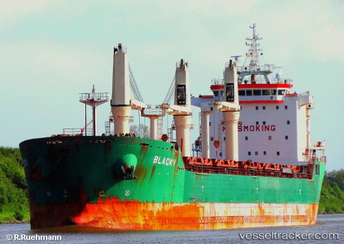
Vessel Blacky IMO: 9393149, MMSI: 212337000 Bulk Carrier
UTC, 6.32563, 3.46279, course: 267, speed: 0.3
UTC, 6.30479, 3.42523, course: 257, speed: 0.7
2026-02-04 19:43:31 UTC, 6.28853, 3.42236, course: 260, speed: 0.5
Live AIS position:
UTC. Near Apapa),
updated 2026-02-04 19:43:31 UTC.
Find the position of the vessel Blacky on the map. The latter are known coordinates and path.
marine traffic ship tracker show on live map
The current position of vessel Blacky is 6.28853 lat / 3.42236 lng. Updated: 2026-02-04 19:43:31 UTCCurrently sailing under the flag of Cyprus
Blacky built in 2008 year
Deadweight:
30801 tDetails:
Last coordinates of the vessel:
UTC, 6.31671, 3.46056, course: 263, speed: 0.8UTC, 6.32563, 3.46279, course: 267, speed: 0.3
UTC, 6.30479, 3.42523, course: 257, speed: 0.7
2026-02-04 19:43:31 UTC, 6.28853, 3.42236, course: 260, speed: 0.5