 vesseltracker.com
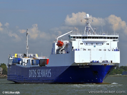
Vessel Blue Carrier 1 IMO: 9186649, MMSI: 241671000 Ro Ro Cargo Ship
UTC, 37.44006, 24.94253, course: 134, speed: 0.2
UTC, 37.52167, 24.55500, course: -1, speed: 15
2026-02-06 18:04:30 UTC, 37.59828, 24.01669, course: 288, speed: 16.3
Live AIS position:
UTC. Near LAVRIO MARINA),
updated 2026-02-06 18:04:30 UTC.
Find the position of the vessel Blue Carrier 1 on the map. The latter are known coordinates and path.
marine traffic ship tracker show on live map
The current position of vessel Blue Carrier 1 is 37.59828 lat / 24.01669 lng. Updated: 2026-02-06 18:04:30 UTCCurrently sailing under the flag of Greece
Blue Carrier 1 built in 2000 year
Deadweight:
4650 tDetails:
Last coordinates of the vessel:
UTC, 37.16822, 25.20675, course: 229, speed: 16.3UTC, 37.44006, 24.94253, course: 134, speed: 0.2
UTC, 37.52167, 24.55500, course: -1, speed: 15
2026-02-06 18:04:30 UTC, 37.59828, 24.01669, course: 288, speed: 16.3