 vesseltracker.com
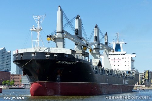
Vessel Blue Master Ii IMO: 9465411, MMSI: 538090451 Multi Purpose Carrier
UTC, -25.94500, 32.85167, course: -1, speed: 0
UTC, -25.94480, 32.85038, course: 148, speed: 0.2
2026-02-06 11:35:08 UTC, -25.94808, 32.84758, course: 59, speed: 0.1
Live AIS position:
UTC. 15 nm E of Maputo),
updated 2026-02-06 11:35:08 UTC.
Find the position of the vessel Blue Master Ii on the map. The latter are known coordinates and path.
marine traffic ship tracker show on live map
The current position of vessel Blue Master Ii is -25.94808 lat / 32.84758 lng. Updated: 2026-02-06 11:35:08 UTCCurrently sailing under the flag of Marshall Is
Blue Master Ii built in 2013 year
Deadweight:
37444 tDetails:
Last coordinates of the vessel:
UTC, -25.94556, 32.85170, course: 237, speed: 0.1UTC, -25.94500, 32.85167, course: -1, speed: 0
UTC, -25.94480, 32.85038, course: 148, speed: 0.2
2026-02-06 11:35:08 UTC, -25.94808, 32.84758, course: 59, speed: 0.1