 vesseltracker.com
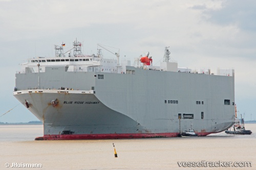
Vessel Blue Ridge Highway IMO: 9510151, MMSI: 355558000 Vehicles Carrier
UTC, -27.06345, 153.30453, course: 340, speed: 18.5
UTC, -26.79379, 153.18140, course: 21, speed: 9.9
2026-02-06 12:08:14 UTC, -26.98510, 153.56956, course: 158, speed: 19.4
Live AIS position:
UTC. 12 nm NE of Bulwer),
updated 2026-02-06 12:08:14 UTC.
Find the position of the vessel Blue Ridge Highway on the map. The latter are known coordinates and path.
marine traffic ship tracker show on live map
The current position of vessel Blue Ridge Highway is -26.98510 lat / 153.56956 lng. Updated: 2026-02-06 12:08:14 UTCDetails:
Last coordinates of the vessel:
UTC, -27.37971, 153.16454, course: 38, speed: 0UTC, -27.06345, 153.30453, course: 340, speed: 18.5
UTC, -26.79379, 153.18140, course: 21, speed: 9.9
2026-02-06 12:08:14 UTC, -26.98510, 153.56956, course: 158, speed: 19.4