 vesseltracker.com
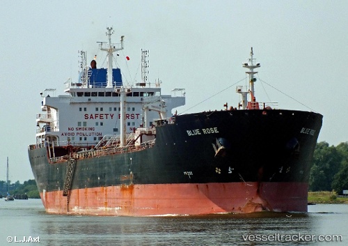
Vessel Blue Rose IMO: 9335915, MMSI: 538002561 Chemical Oil Products Tanker
UTC, 39.04574, 9.11356, course: 254, speed: 0.1
UTC, 39.04667, 9.11167, course: -1, speed: 0
2026-02-06 21:18:44 UTC, 39.04667, 9.11167, course: -1, speed: 0
Live AIS position:
UTC. Near SARROCH),
updated 2026-02-06 21:18:44 UTC.
Find the position of the vessel Blue Rose on the map. The latter are known coordinates and path.
marine traffic ship tracker show on live map
The current position of vessel Blue Rose is 39.04667 lat / 9.11167 lng. Updated: 2026-02-06 21:18:44 UTCCurrently sailing under the flag of Marshall Is
Blue Rose built in 2007 year
Deadweight:
38402 tDetails:
Last coordinates of the vessel:
UTC, 39.04500, 9.11333, course: -1, speed: 0UTC, 39.04574, 9.11356, course: 254, speed: 0.1
UTC, 39.04667, 9.11167, course: -1, speed: 0
2026-02-06 21:18:44 UTC, 39.04667, 9.11167, course: -1, speed: 0