 vesseltracker.com
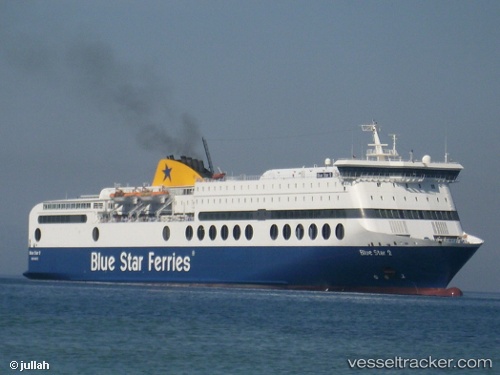
Vessel Blue Star 2 IMO: 9207584, MMSI: 239737000 Passenger Ro Ro Cargo Ship
UTC, 37.29010, 26.58987, course: 345, speed: 24.9
UTC, 37.27322, 26.14473, course: 269, speed: 20.8
2026-02-06 14:21:00 UTC, 37.34142, 24.92463, course: 268, speed: 20.2
Live AIS position:
UTC. Near Syra Island),
updated 2026-02-06 14:21:00 UTC.
Find the position of the vessel Blue Star 2 on the map. The latter are known coordinates and path.
marine traffic ship tracker show on live map
The current position of vessel Blue Star 2 is 37.34142 lat / 24.92463 lng. Updated: 2026-02-06 14:21:00 UTCCurrently sailing under the flag of Greece
Blue Star 2 built in 2000 year
Deadweight:
5075 tDetails:
Last coordinates of the vessel:
UTC, 36.94282, 26.99357, course: 102, speed: 11.1UTC, 37.29010, 26.58987, course: 345, speed: 24.9
UTC, 37.27322, 26.14473, course: 269, speed: 20.8
2026-02-06 14:21:00 UTC, 37.34142, 24.92463, course: 268, speed: 20.2