 vesseltracker.com
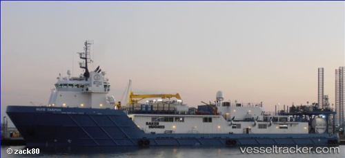
Vessel Blue Tarpon IMO: 9529906, MMSI: 366515000 Offshore Tug Supply Ship
UTC, 28.18614, -89.40538, course: 284, speed: 0.2
UTC, 28.18614, -89.40533, course: 285, speed: 0.3
2026-02-07 11:54:47 UTC, 28.18500, -89.40500, course: -1, speed: 0
Live AIS position:
UTC. 49 nm S of Southwest Pass),
updated 2026-02-07 11:54:47 UTC.
Find the position of the vessel Blue Tarpon on the map. The latter are known coordinates and path.
marine traffic ship tracker show on live map
The current position of vessel Blue Tarpon is 28.18500 lat / -89.40500 lng. Updated: 2026-02-07 11:54:47 UTCCurrently sailing under the flag of USA
Blue Tarpon built in 2010 year
Deadweight:
3643 tDetails:
Last coordinates of the vessel:
UTC, 28.18613, -89.40533, course: 283, speed: 0.1UTC, 28.18614, -89.40538, course: 284, speed: 0.2
UTC, 28.18614, -89.40533, course: 285, speed: 0.3
2026-02-07 11:54:47 UTC, 28.18500, -89.40500, course: -1, speed: 0