 vesseltracker.com
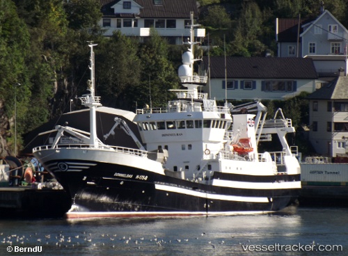
Vessel Boemmelbas IMO: 9223148, MMSI: 257180000 Fish Carrier
UTC, 64.95440, 11.51200, course: 60, speed: 11.2
UTC, 65.12420, 11.81450, course: 16, speed: 11.3
2026-02-05 11:47:35 UTC, 65.52770, 12.02118, course: 28, speed: 10.8
Live AIS position:
UTC. Near BRONNOYSUND),
updated 2026-02-05 11:47:35 UTC.
Find the position of the vessel Boemmelbas on the map. The latter are known coordinates and path.
marine traffic ship tracker show on live map
The current position of vessel Boemmelbas is 65.52770 lat / 12.02118 lng. Updated: 2026-02-05 11:47:35 UTCCurrently sailing under the flag of Norway
Boemmelbas built in 2000 year
Deadweight:
620 tDetails:
Last coordinates of the vessel:
UTC, 64.61598, 10.67933, course: 46, speed: 11UTC, 64.95440, 11.51200, course: 60, speed: 11.2
UTC, 65.12420, 11.81450, course: 16, speed: 11.3
2026-02-05 11:47:35 UTC, 65.52770, 12.02118, course: 28, speed: 10.8