 vesseltracker.com
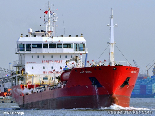
Vessel Bomar Mercury IMO: 9428889, MMSI: 256541000 Chemical Oil Products Tanker
UTC, 27.09448, -13.43060, course: 14, speed: 0.1
UTC, 27.09448, -13.43059, course: 13, speed: 0.1
2026-02-05 01:13:11 UTC, 27.09446, -13.43061, course: 13, speed: 0
Live AIS position:
UTC. Near Aaiun),
updated 2026-02-05 01:13:11 UTC.
Find the position of the vessel Bomar Mercury on the map. The latter are known coordinates and path.
marine traffic ship tracker show on live map
The current position of vessel Bomar Mercury is 27.09446 lat / -13.43061 lng. Updated: 2026-02-05 01:13:11 UTCCurrently sailing under the flag of Malta
Bomar Mercury built in 2008 year
Deadweight:
7003 tDetails:
Last coordinates of the vessel:
UTC, 27.09452, -13.43061, course: 13, speed: 0UTC, 27.09448, -13.43060, course: 14, speed: 0.1
UTC, 27.09448, -13.43059, course: 13, speed: 0.1
2026-02-05 01:13:11 UTC, 27.09446, -13.43061, course: 13, speed: 0