 vesseltracker.com
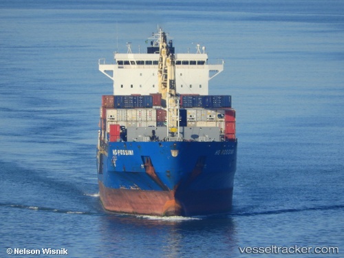
Vessel Bomar Rossi IMO: 9565338, MMSI: 636018553 Container Ship
UTC, 22.47607, -97.88505, course: 347, speed: 0
UTC, 22.47604, -97.88502, course: 347, speed: 0
2026-02-06 05:28:23 UTC, 22.47596, -97.88499, course: 347, speed: 0
Live AIS position:
UTC. Near Miramar),
updated 2026-02-06 05:28:23 UTC.
Find the position of the vessel Bomar Rossi on the map. The latter are known coordinates and path.
marine traffic ship tracker show on live map
The current position of vessel Bomar Rossi is 22.47596 lat / -97.88499 lng. Updated: 2026-02-06 05:28:23 UTCDetails:
Last coordinates of the vessel:
UTC, 22.47614, -97.88505, course: 347, speed: 0UTC, 22.47607, -97.88505, course: 347, speed: 0
UTC, 22.47604, -97.88502, course: 347, speed: 0
2026-02-06 05:28:23 UTC, 22.47596, -97.88499, course: 347, speed: 0