 vesseltracker.com
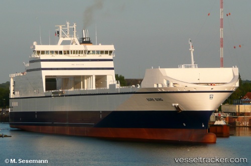
Vessel Bore Song IMO: 9443566, MMSI: 244130690 Ro Ro Cargo Ship
UTC, 57.67229, 19.84502, course: 36, speed: 17.2
UTC, 58.00113, 20.28984, course: 36, speed: 17.4
2026-02-01 04:06:57 UTC, 58.59031, 21.08992, course: 36, speed: 17.3
Live AIS position:
UTC. 28 nm NW of Vikati Sadam),
updated 2026-02-01 04:06:57 UTC.
Find the position of the vessel Bore Song on the map. The latter are known coordinates and path.
marine traffic ship tracker show on live map
The current position of vessel Bore Song is 58.59031 lat / 21.08992 lng. Updated: 2026-02-01 04:06:57 UTCCurrently sailing under the flag of Netherlands
Bore Song built in 2011 year
Deadweight:
13375 tDetails:
Last coordinates of the vessel:
UTC, 57.13354, 19.14709, course: 37, speed: 17.1UTC, 57.67229, 19.84502, course: 36, speed: 17.2
UTC, 58.00113, 20.28984, course: 36, speed: 17.4
2026-02-01 04:06:57 UTC, 58.59031, 21.08992, course: 36, speed: 17.3