 vesseltracker.com
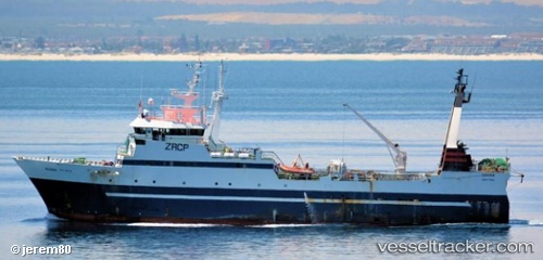
Vessel Boronia IMO: 8901547, MMSI: 601572000 Fishing Vessel
UTC, -34.43167, 25.91333, course: -1, speed: 3
UTC, -34.47333, 25.77500, course: -1, speed: 3
2026-03-03 23:32:11 UTC, -34.49530, 25.66803, course: 256, speed: 3.4
Live AIS position:
UTC. 30 nm S of Mount Pleasant),
updated 2026-03-03 23:32:11 UTC.
Find the position of the vessel Boronia on the map. The latter are known coordinates and path.
marine traffic ship tracker show on live map
The current position of vessel Boronia is -34.49530 lat / 25.66803 lng. Updated: 2026-03-03 23:32:11 UTCCurrently sailing under the flag of South Africa
Boronia built in 1992 year
Deadweight:
1283 tDetails:
Last coordinates of the vessel:
UTC, -34.47177, 25.81319, course: 87, speed: 3.8UTC, -34.43167, 25.91333, course: -1, speed: 3
UTC, -34.47333, 25.77500, course: -1, speed: 3
2026-03-03 23:32:11 UTC, -34.49530, 25.66803, course: 256, speed: 3.4