 vesseltracker.com
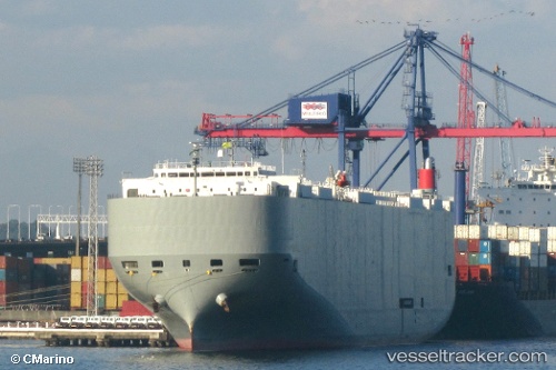
Vessel Brasilia Highway IMO: 9519119, MMSI: 356073000 Vehicles Carrier
UTC, -8.37456, -34.84584, course: 43, speed: 0.1
UTC, -8.38246, -34.68407, course: 132, speed: 1.4
2026-02-06 15:29:05 UTC, -8.37989, -34.75558, course: 291, speed: 5.1
Live AIS position:
UTC. Near Cabo de Santo Agostinho),
updated 2026-02-06 15:29:05 UTC.
Find the position of the vessel Brasilia Highway on the map. The latter are known coordinates and path.
marine traffic ship tracker show on live map
The current position of vessel Brasilia Highway is -8.37989 lat / -34.75558 lng. Updated: 2026-02-06 15:29:05 UTCCurrently sailing under the flag of Panama
Brasilia Highway built in 2009 year
Deadweight:
18793 tDetails:
Last coordinates of the vessel:
UTC, -8.37485, -34.84578, course: 45, speed: 0.2UTC, -8.37456, -34.84584, course: 43, speed: 0.1
UTC, -8.38246, -34.68407, course: 132, speed: 1.4
2026-02-06 15:29:05 UTC, -8.37989, -34.75558, course: 291, speed: 5.1