 vesseltracker.com
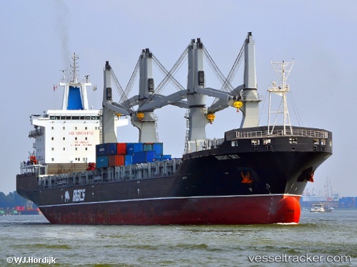
Vessel Bright Sky IMO: 9465435, MMSI: 538090453 Multi Purpose Carrier
UTC, 51.88113, 4.41803, course: 288, speed: 0
UTC, 51.88112, 4.41805, course: 288, speed: 0
2026-02-04 19:43:51 UTC, 51.88110, 4.41805, course: 288, speed: 0
Live AIS position:
UTC. Near Heijplaat),
updated 2026-02-04 19:43:51 UTC.
Find the position of the vessel Bright Sky on the map. The latter are known coordinates and path.
marine traffic ship tracker show on live map
The current position of vessel Bright Sky is 51.88110 lat / 4.41805 lng. Updated: 2026-02-04 19:43:51 UTCCurrently sailing under the flag of Marshall Is
Bright Sky built in 2013 year
Deadweight:
37472 tDetails:
Last coordinates of the vessel:
UTC, 51.88114, 4.41810, course: 289, speed: 0UTC, 51.88113, 4.41803, course: 288, speed: 0
UTC, 51.88112, 4.41805, course: 288, speed: 0
2026-02-04 19:43:51 UTC, 51.88110, 4.41805, course: 288, speed: 0