 vesseltracker.com
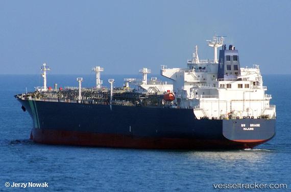
Vessel Bw Brage IMO: 9732539, MMSI: 538006837 Lpg Tanker
UTC, 28.93667, -95.33333, course: -1, speed: 0
UTC, 28.93667, -95.33333, course: -1, speed: 0
2026-03-04 03:58:57 UTC, 28.93667, -95.33333, course: -1, speed: 0
Live AIS position:
UTC. Near Quintana),
updated 2026-03-04 03:58:57 UTC.
Find the position of the vessel Bw Brage on the map. The latter are known coordinates and path.
marine traffic ship tracker show on live map
The current position of vessel Bw Brage is 28.93667 lat / -95.33333 lng. Updated: 2026-03-04 03:58:57 UTCDetails:
Last coordinates of the vessel:
UTC, 28.93680, -95.33379, course: -1, speed: 0UTC, 28.93667, -95.33333, course: -1, speed: 0
UTC, 28.93667, -95.33333, course: -1, speed: 0
2026-03-04 03:58:57 UTC, 28.93667, -95.33333, course: -1, speed: 0