 vesseltracker.com
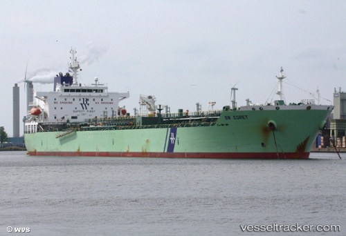
Vessel Bw Egret IMO: 9607174, MMSI: 565504000 Chemical Oil Products Tanker
UTC, 28.54333, -89.24333, course: -1, speed: 5
UTC, 28.61103, -89.22792, course: -1, speed: 1.6
2026-03-04 03:20:23 UTC, 28.59090, -89.18897, course: -1, speed: 4.5
Live AIS position:
UTC. 25 nm S of Port Eads),
updated 2026-03-04 03:20:23 UTC.
Find the position of the vessel Bw Egret on the map. The latter are known coordinates and path.
marine traffic ship tracker show on live map
The current position of vessel Bw Egret is 28.59090 lat / -89.18897 lng. Updated: 2026-03-04 03:20:23 UTCDetails:
Last coordinates of the vessel:
UTC, 28.56168, -89.20560, course: -1, speed: 1.7UTC, 28.54333, -89.24333, course: -1, speed: 5
UTC, 28.61103, -89.22792, course: -1, speed: 1.6
2026-03-04 03:20:23 UTC, 28.59090, -89.18897, course: -1, speed: 4.5