vessel 'CARO' IMO: 9446879, vesseltracker.com
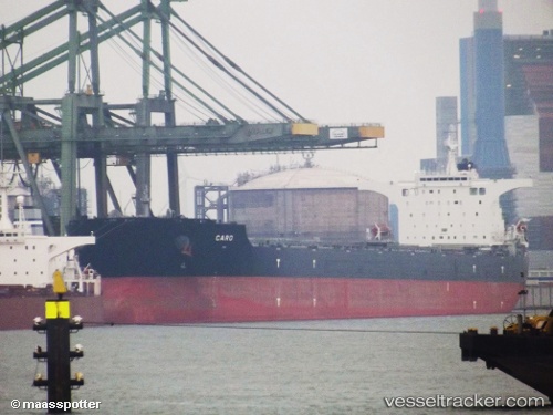
Vessel 'CARO' IMO: 9446879,
MMSI: 232027948 callsign: size: x

Find the position of the vessel 'CARO' on the map. The latter are known coordinates and path.

marine traffic ship tracker show on live map

The current position of vessel 'CARO' is -22.3178 lat / -38.0238 lng. Updated: 2025-07-12 07:34:27 UTC
Details:


Last coordinates of the vessel:
UTC, -22.033, -38.6319, course: 116, speed: 11.5
UTC, -22.1177, -38.4479, course: 118, speed: 11.5
UTC, -22.285, -38.0963, course: 116, speed: 11.8
2025-07-12 07:34:27 UTC, -22.3178, -38.0238, course: 116, speed: 11.9

Track of the vessel in the last 14 days


Most frequent ports a vessels calls at 'CARO' (232027948):

Dagu Bar, traffic: 8
Taku Bar, traffic: 8
Selat Lombok, traffic: 4
Come By Chance, traffic: 3
Port Headland, traffic: 2
Port Walcot, traffic: 2
Samson Point, traffic: 2
Singapore, traffic: 2
Dagu, traffic: 2
Ta-Ku, traffic: 2
Port Hedland, traffic: 2
Sebang, traffic: 1
Richards Bay, traffic: 1
Amsterdam, traffic: 1
Sambu, traffic: 1

Link to the map:


Find another ship

'CARO' (232027948) last ports (portcalls and passsages)

Sebang | 2023-12-09 20:53:32
Nagoya | 2022-12-17 17:52:54
Yokkaichi | 2022-12-15 02:28:59
Kashima Ko | 2022-12-11 23:52:34
Bur Ibrahim | 2022-11-09 17:07:09
Strait Of Gibraltar | 2022-11-02 12:03:15
Come By Chance | 2022-10-14 02:15:43
Ijmuiden | 2022-10-05 04:27:15
Amsterdam | 2022-10-01 12:03:16
Richards Bay | 2022-08-18 19:24:00
Port Headland | 2022-05-13 01:15:44
Port Headland | 2022-02-25 00:10:05
Selat Lombok | 2022-01-23 17:17:58
Port Walcot | 2022-01-17 02:36:29
Selat Lombok | 2022-01-14 09:29:46
Taku Bar | 2022-01-03 15:02:52
Taku Bar | 2022-01-03 14:43:32
Dagu Bar | 2022-01-03 14:00:53
Ta-Ku | 2021-12-29 14:50:11
Dagu Bar | 2021-12-29 12:46:20
Taku Bar | 2021-12-29 12:31:20
Taku Bar | 2021-12-29 12:01:00
Singapore | 2021-12-17 18:00:20