 vesseltracker.com
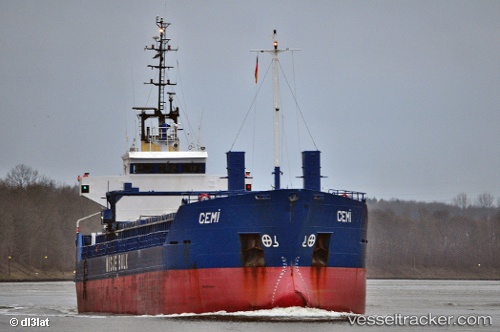
Vessel CEMILE IMO: 8822612, MMSI: 577439000 General Cargo Ship
UTC, 36.70044, 36.18996, course: 246, speed: 0
UTC, 36.70043, 36.18998, course: 245, speed: 0
2026-02-05 14:33:52 UTC, 36.70045, 36.18999, course: 245, speed: 0
Live AIS position:
UTC. Near Isdemir),
updated 2026-02-05 14:33:52 UTC.
Find the position of the vessel CEMILE on the map. The latter are known coordinates and path.
marine traffic ship tracker show on live map
The current position of vessel CEMILE is 36.70045 lat / 36.18999 lng. Updated: 2026-02-05 14:33:52 UTCCurrently sailing under the flag of Vanuatu
CEMILE built in 1991 year
Deadweight:
4270 tDetails:
Last coordinates of the vessel:
UTC, 36.70043, 36.18999, course: 246, speed: 0.1UTC, 36.70044, 36.18996, course: 246, speed: 0
UTC, 36.70043, 36.18998, course: 245, speed: 0
2026-02-05 14:33:52 UTC, 36.70045, 36.18999, course: 245, speed: 0