 vesseltracker.com
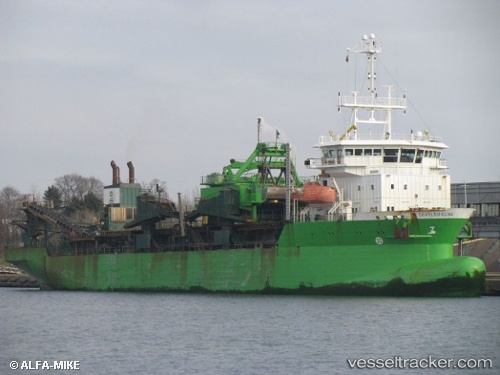
Vessel CHARLEMAGNE IMO: 9243289, MMSI: 205796000 Hopper Dredger
UTC, 50.30454, 0.71398, course: 45, speed: 12.7
UTC, 50.73795, 1.40545, course: 21, speed: 12.7
2026-02-24 22:11:09 UTC, 51.03741, 1.67316, course: 54, speed: 11.3
Live AIS position:
UTC. Near Sangatte),
updated 2026-02-24 22:11:09 UTC.
Find the position of the vessel CHARLEMAGNE on the map. The latter are known coordinates and path.
marine traffic ship tracker show on live map
The current position of vessel CHARLEMAGNE is 51.03741 lat / 1.67316 lng. Updated: 2026-02-24 22:11:09 UTCCurrently sailing under the flag of Belgium
CHARLEMAGNE built in 2002 year
Deadweight:
10650 tDetails:
Last coordinates of the vessel:
UTC, 50.09399, 0.44137, course: 302, speed: 4.3UTC, 50.30454, 0.71398, course: 45, speed: 12.7
UTC, 50.73795, 1.40545, course: 21, speed: 12.7
2026-02-24 22:11:09 UTC, 51.03741, 1.67316, course: 54, speed: 11.3