 vesseltracker.com
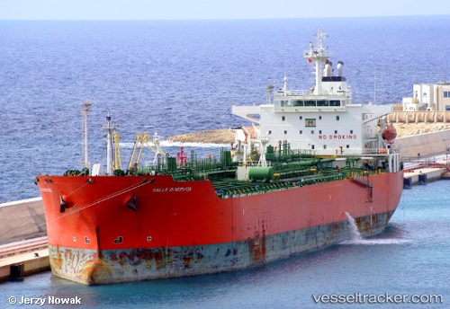
Vessel CHERRY TONDA IMO: 9288942, MMSI: 352003888 Chemical Oil Products Tanker
UTC, 1.72583, 101.42550, course: 101, speed: 0.1
UTC, 1.72500, 101.42500, course: -1, speed: 0
2026-02-22 12:08:18 UTC, 1.72167, 101.42667, course: -1, speed: 0
Live AIS position:
UTC. Near Dumai),
updated 2026-02-22 12:08:18 UTC.
Find the position of the vessel CHERRY TONDA on the map. The latter are known coordinates and path.
marine traffic ship tracker show on live map
The current position of vessel CHERRY TONDA is 1.72167 lat / 101.42667 lng. Updated: 2026-02-22 12:08:18 UTCCurrently sailing under the flag of Panama
Details:
Last coordinates of the vessel:
UTC, 1.72516, 101.42550, course: 82, speed: 0.3UTC, 1.72583, 101.42550, course: 101, speed: 0.1
UTC, 1.72500, 101.42500, course: -1, speed: 0
2026-02-22 12:08:18 UTC, 1.72167, 101.42667, course: -1, speed: 0