 vesseltracker.com
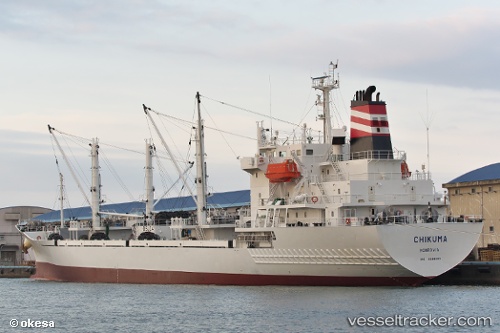
Vessel CHIKUMA IMO: 9666493, MMSI: 371500000 Refrigerated Cargo Ship
UTC, -2.93667, 62.28333, course: -1, speed: 2
UTC, -2.90167, 62.39167, course: -1, speed: 2
2026-02-22 21:40:23 UTC, -2.87500, 62.46833, course: -1, speed: 2
Live AIS position:
UTC. 100 nm E of Akpo),
updated 2026-02-22 21:40:23 UTC.
Find the position of the vessel CHIKUMA on the map. The latter are known coordinates and path.
marine traffic ship tracker show on live map
The current position of vessel CHIKUMA is -2.87500 lat / 62.46833 lng. Updated: 2026-02-22 21:40:23 UTCCurrently sailing under the flag of Panama
CHIKUMA built in 2013 year
Deadweight:
7303 tDetails:
Last coordinates of the vessel:
UTC, -2.95500, 62.22167, course: -1, speed: 2UTC, -2.93667, 62.28333, course: -1, speed: 2
UTC, -2.90167, 62.39167, course: -1, speed: 2
2026-02-22 21:40:23 UTC, -2.87500, 62.46833, course: -1, speed: 2