 vesseltracker.com
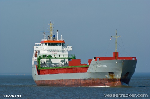
Vessel CLARA IMO: 9312676, MMSI: 304444000 General Cargo Ship
UTC, 43.66020, -7.09517, course: 261, speed: 4
UTC, 43.65167, -6.99500, course: -1, speed: 4
2026-01-31 01:30:14 UTC, 43.65667, -6.88833, course: -1, speed: 3
Live AIS position:
UTC. Near Tapia de Casariego),
updated 2026-01-31 01:30:14 UTC.
Find the position of the vessel CLARA on the map. The latter are known coordinates and path.
marine traffic ship tracker show on live map
The current position of vessel CLARA is 43.65667 lat / -6.88833 lng. Updated: 2026-01-31 01:30:14 UTCCurrently sailing under the flag of Antigua and Barbuda
CLARA built in 2004 year
Deadweight:
5744 tDetails:
Last coordinates of the vessel:
UTC, 43.66000, -6.87833, course: -1, speed: 0UTC, 43.66020, -7.09517, course: 261, speed: 4
UTC, 43.65167, -6.99500, course: -1, speed: 4
2026-01-31 01:30:14 UTC, 43.65667, -6.88833, course: -1, speed: 3