 vesseltracker.com
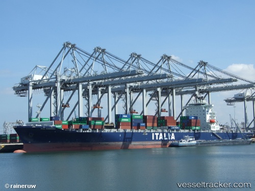
Vessel CMA CGM NANTONG IMO: 9349629, MMSI: 229916000 Container Ship
UTC, 1.25992, 103.78871, course: 31, speed: 0.1
UTC, 1.25996, 103.78870, course: 30, speed: 0
2026-02-01 14:25:53 UTC, 1.25833, 103.78833, course: -1, speed: 0
Live AIS position:
UTC. Near Pasir Panjang Wharves),
updated 2026-02-01 14:25:53 UTC.
Find the position of the vessel CMA CGM NANTONG on the map. The latter are known coordinates and path.
marine traffic ship tracker show on live map
The current position of vessel CMA CGM NANTONG is 1.25833 lat / 103.78833 lng. Updated: 2026-02-01 14:25:53 UTCCurrently sailing under the flag of Malta
CMA CGM NANTONG built in 2008 year
Deadweight:
53644 tDetails:
Last coordinates of the vessel:
UTC, 1.25992, 103.78871, course: 31, speed: 0.1UTC, 1.25992, 103.78871, course: 31, speed: 0.1
UTC, 1.25996, 103.78870, course: 30, speed: 0
2026-02-01 14:25:53 UTC, 1.25833, 103.78833, course: -1, speed: 0